When a WATCH is Issued
What is a Tropical Storm or Hurricane Watch?
An announcement from the National Hurricane Center that sustained winds of tropical storm or hurricane force are possible within the specified area within 48 hours in association with a tropical, subtropical, or post-tropical cyclone.
Get the latest forecast and projected impacts for your community.
By now, the storm will be dominating local and national headlines. Just remember, that Florida State University makes all its decisions based on official forecasts from the National Hurricane Center and National Weather Service - Tallahassee. Some other private meteorologists or media may have differing opinions.
Get the latest information and instructions from local officials.
Consult the FSU Alerts Page and Keep FSU Safe on Facebook and Twitter for campus-specific information, operating conditions, cancellation or closure announcements, or other instructions. Also check the Leon County Emergency Information Page and the City of Tallahassee website for community-wide information and instructions.
Finalize your plans.
Hopefully by now, you have adequately planned ahead and prepared for this moment. Now it is time to finalize those plans. Are you going to evacuate? Are you going to stay? Do you have your survival kit ready? Have you contacted your family and told them your plans? Do you know what your are going to do with your kids or pets? If you haven't adequately prepared before now, be prepared to encounter the last-minute rush, crowds, and shortage of supplies at area stores. Now is your last chance to prepare. Tomorrow will be crunch day.
If you need to evacuate, start packing now.
If you determined during preparedness that you need to evacuate due to storm surge, inland flood zone, or inadequate housing, then now is the time to pack up. Collect and load your essential belongings and survival kit into your car. Top off the fuel tank in your vehicle. Plan your route. Leave early enough to avoid traffic and getting stuck on the road. Communicate your plan and movements regularly with family or friends. If you're ready to go, there's no harm in leaving early to beat the rush. If you need to miss a class or work, discuss it with your instructor or supervisor first.
If you are going to stay, stock up now.
If you determined during preparedness that you are going to stay, then now is the time to stock up and get ready. Collect up essential belongings and your survival kit. Don't forget to refill your prescription medications. Get cash; banks may not open, ATMs and credit card machines might not work after the storm. Identify the location within your house that you will ride out the storm, such as an interior room, closet, hallway or bathroom on the lowest floor. Try to put as many walls between you and the outside as possible, and by all means avoid any unprotected glass doors or windows.
Take steps to protect property and possessions.
Now is the time to bring in outdoor items, get electronics up off the floor, wrap valuables in plastic bags or sheeting. If you own your property, install or deploy your hurricane shutters. Clear or report any blocked storm water drains or ditches.
When a WARNING is Issued
What is a Tropical Storm or Hurricane Warning?
An announcement from the National Hurricane Center that sustained winds of tropical storm or hurricane force are expected somewhere within the specified area within 36 hours in association with a tropical, subtropical, or post-tropical cyclone.
Get the latest forecast and projected impacts for your community.
Surely you've read all the headlines by now. Just remember, that Florida State University makes all its decisions based on official forecasts from the National Hurricane Center and National Weather Service - Tallahassee. Some other private meteorologists or media may have differing opinions.
Get the latest information and instructions from local officials.
Consult the FSU Alerts Page and Keep FSU Safe on Facebook and Twitter for campus-specific information, operating conditions, cancellation or closure announcements, or other instructions. Also check the Leon County Emergency Information Page and the City of Tallahassee website for community-wide information and instructions.
Put your plans into action.
The time to prepare has come to an end. Now is the time to act. If you're going to evacuate, leave now. If you're going to stay, get settled in. It's time to put your full focus on the storm and its potential impacts. Tune in to updates from forecasters and media. While some national outlets may be more appealing, we encourage you to include local sources of information as well. Local media will have the most current information pertinent to you. Be sure to check in with family and friends; update them on your final plans.
Final property protection actions.
Unplug or turn off any unnecessary electrical items. If you are leaving, turn off electricity at the main breaker. Put valuable items in your empty appliances such as washer, dryer, oven or microwave. Lock windows and doors. Put the final charge on cell phones, laptops, tablets, and other rechargable devices. Clean and fill your bath tub with water. Do your last load of laundry.
Riding Out the Storm
When is it time to "hunker down"?
"Hunker down" is a popular term in the South. It refers to the point in time before a hurricane that you get to your final safe place and begin to ride out the storm. Most emergency officials use the onset of sustained tropical storm force winds (greater than 38mph) as the benchmark for when you should be off the roads and head indoors. The onset of sustained gale force winds (greater than 55mph) is the time to get to your interior safe place and stay there until the storm subsides.
Get inside and stay away from unprotected glass doors and windows!
One of the biggest threats from a tropical storm or hurricane in Tallahassee is breaking glass from high winds and debris. As tempting as it may be to peek outside to see how bad it is or record that video you plan to post on social media, this is your biggest chance for getting hurt. This is why Housing staff will move residence hall occupants into interior hallways and stairwells.
Actively monitor the storm's progress.
As long as you have electric power and connectivity, actively monitor the storms progress with television media and the internet. Once you lose power, turn on your battery-operated radio to local radio stations for updates. Save your cell phone battery for communicating (voice and text) with your family. Refrain from using up all your battery surfing the web or using apps. Don't trust rumors; stay tuned to local media and official sources for information.
Reserve 911 for life-threatening emergencies only.
A lot of bad and scary things can happen during the middle of a storm. The entire community is being impacted just like you are. Do not call 911 unless you have an immediately life-threatening situation (major injury, fire, etc.). Keep in mind that most emergency services (police, fire, EMS) will be unable to respond during the peak of the storm, as vehicle operation in unsafe in high velocity winds. A high wind warning is issued when sustained winds of 40 mph, or greater, or gusts to 58 mph, or greater, are expected (NWS). Sadly, you're on your own at that point, until responders are allowed back on the road. This is why having a plan, first aid training, and an emergency kit is so important.
Beware the eye of the storm.
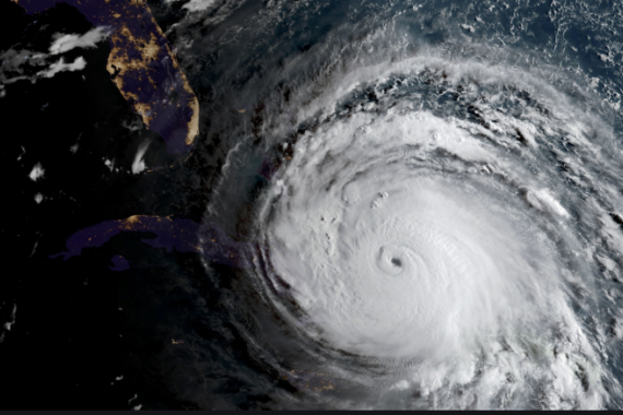
Hurricanes, particularly strong ones, will have an "eye" at the center of the storm. The eye of a hurricane is surprisingly calm of most winds, free of rain and can quite possibly even see some sunshine. It is often very tempting for people to go outside during the eye of the storm to check things out. This is extremely dangerous! At some point, the opposite eye wall will approach. The eye wall most often contains the most intense winds. You can go from calm to catastrophic in just a matter of minutes. Stay inside in your safe place.

